Geodetic News
|
FAA issues notice of GPS interference testing
|
| Tuesday, March 24, 2026 |
The Federal Aviation Administration (FAA) has issued the following notice of GPS interference testing that may result in unreliable or unavailable GPS signal:
|
|
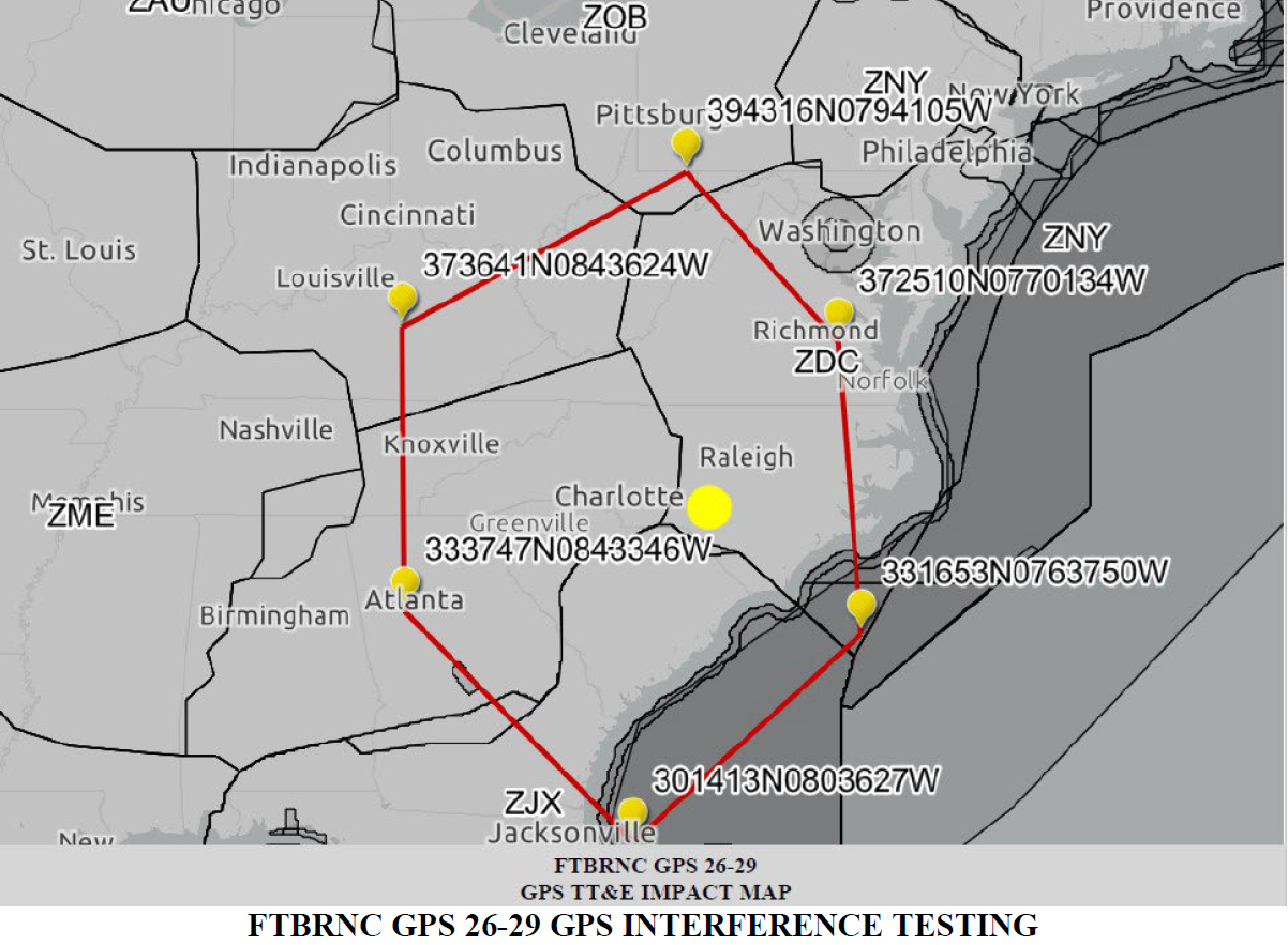
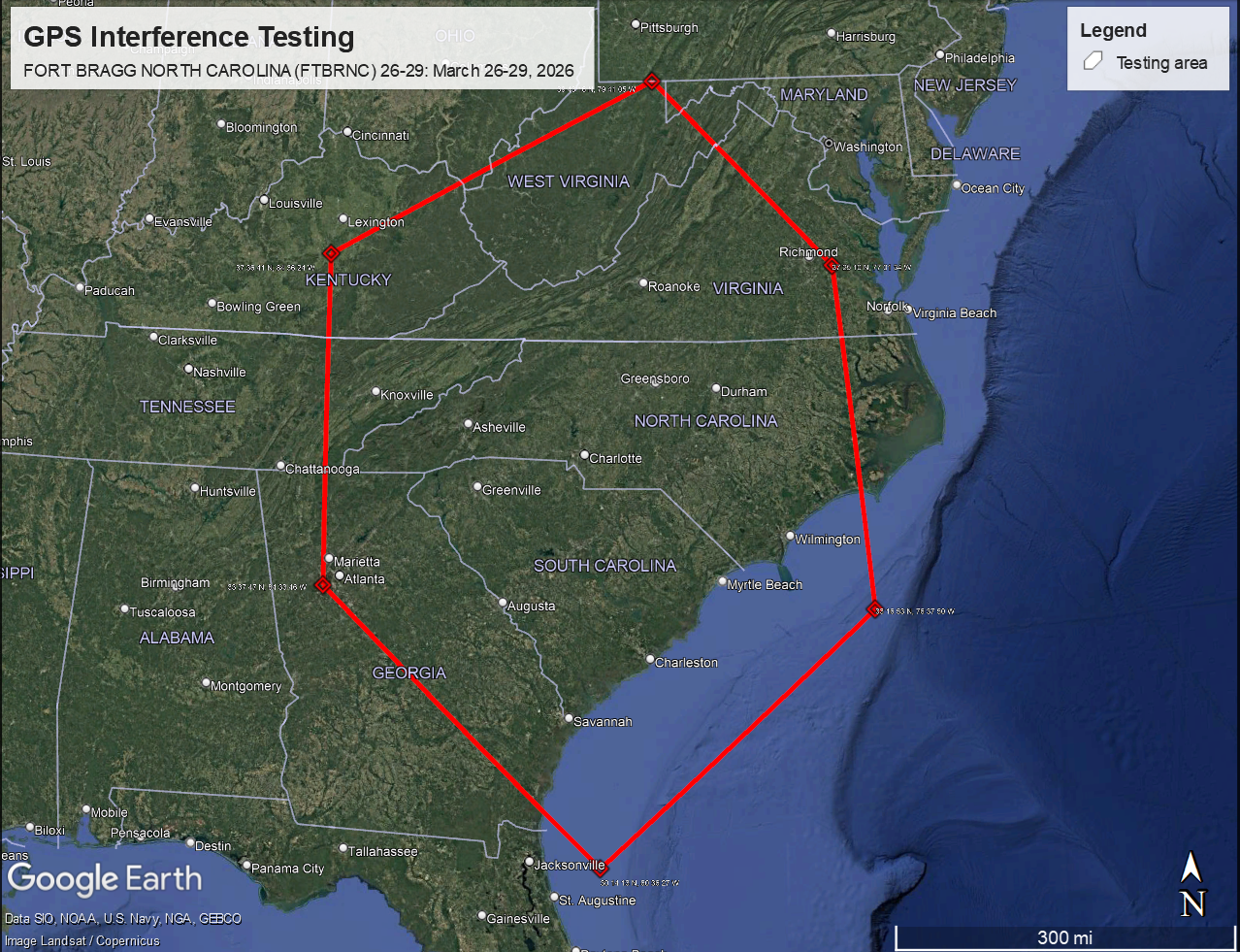
FLIGHT ADVISORY GPS INTERFERENCE TESTING
FORT BRAGG NORTH CAROLINA (FTBRNC) 26-29
26 – 29 March 2026 / Fort Bragg, NC
|
|
Please note that this particular test is not the typical GPS interference test that is centered at a point and impacting an expanding radius with increasing elevation like an upside-down truncated cone. Rather, this test will impact the following area from the surface to UNL (altitudes greater than 99,900 FT):
|
The testing will be conducted each day from 2:30 pm EDT to 10:30 pm EDT.
Note: The notice has the dates from March 26-30, but that is because of using UTC times, such that the evening testing will end each night at 0230Z on the next day. When the times are put in EDT, then the testing ends each night at 10:30 pm EDT.
|
|
NC Geodetic Survey help email addresses
|
|
Those needing to contact NC Geodetic Survey for general help may use the email address below.
|
|
|
|
Those needing help regarding the NC Real-Time Network (NCRTN) may use the email address below.
|
|
|
|
NC Geodetic Survey CORS fund donation page
|
|
Those wishing to donate to the NCGS CORS fund may do so at the link below.
|
|
|
|
This link is also accessible via the CORS/GNSS page.
|
|
Geodetic News Archive
|
|
Geodetic news items older than approximately 6 months (unless deemed critical) as well as expired GPS interference testing notices can be found on the news archive page at the link below.
|
|
|
|
Real Time Network Sensor Map
|
|
To view the real time network sensor map please visit the link below.
|
|
|
|
Beta NGS Map
|
|
In the event that the NCGS Geodetic Control Database is unavailable, users may find the Beta NGS Map, accessible at the link below, a useful alternate resource.
|
|
|